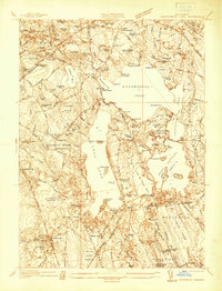
1937 Map of Assawompset Pond
USGS Topo · Published 1937About this map
Assawompset Pond and its interconnected neighbors, Long Pond and Great Quittacas Pond, dominate this 1930s landscape in the lake country of southeastern Massachusetts. The map reveals a complex water management system for regional supply, including the Taunton Water Works and New Bedford Water Works. This era shows a mix of older rural settlement patterns and emerging recreation sites, such as Camp Joe Hooker Race Track, Staples Shore, and Nelsons Grove along the northern banks.
Find a feature on this map
140 named features on this map. Tap any name to fly to it.
Don’t see what you’re looking for? This feature index may not catch every label — zoom into the map to look around manually.
Map Details
Editions of this 1937 Assawompset Pond Map
This is the sole edition of this map. No revisions or reprints were ever made.
Other maps of this area

1885 · New Bedford
USGS Topo · 1:62,500

1885 · Middleboro
USGS Topo · 1:62,500

1885 · Taunton
USGS Topo · 1:62,500

1888 · New Bedford
USGS Topo · 1:62,500

1888 · Fall River
USGS Topo · 1:62,500

1888 · Taunton
USGS Topo · 1:62,500

1888 · Middleboro
USGS Topo · 1:62,500

1893 · Taunton
USGS Topo · 1:62,500

1893 · Middleboro
USGS Topo · 1:62,500

1893 · Fall River
USGS Topo · 1:62,500