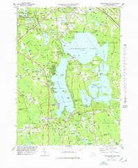
1978 Map of Assawompset Pond
USGS Topo · Published 1979About this map
The massive expanse of Assawompset Pond dominates this landscape, surrounded by an intricate chain of smaller water bodies including Pocksha Pond, Great Quittacas Pond, and Long Pond. By the late 1970s, the area reflects a transition between its agricultural roots and residential growth, with numerous shorefront developments like Buena Vista Shores, Huckleberry Shores, and Churchill Shores lining the western banks. The economy is heavily influenced by the presence of Cranberry Bogs scattered throughout the lowlands, particularly in the vicinity of the Keene River and Cedar Swamp.
Find a feature on this map
114 named features on this map. Tap any name to fly to it.
Don’t see what you’re looking for? This feature index may not catch every label — zoom into the map to look around manually.
Map Details
Editions of this 1978 Assawompset Pond Map
This is the sole edition of this map. No revisions or reprints were ever made.
Other maps of this area

1885 · New Bedford
USGS Topo · 1:62,500

1885 · Middleboro
USGS Topo · 1:62,500

1885 · Taunton
USGS Topo · 1:62,500

1888 · New Bedford
USGS Topo · 1:62,500

1888 · Fall River
USGS Topo · 1:62,500

1888 · Taunton
USGS Topo · 1:62,500

1888 · Middleboro
USGS Topo · 1:62,500

1893 · Taunton
USGS Topo · 1:62,500

1893 · Middleboro
USGS Topo · 1:62,500

1893 · Fall River
USGS Topo · 1:62,500