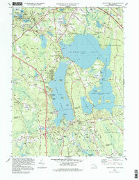
1997 Map of Assawompset Pond
USGS Topo · Published 1999About this map
Assawompset Pond dominates this landscape in southern Massachusetts, surrounded by a complex network of freshwater bodies including Long Pond, Great Quittacas Pond, and Pocksha Pond. The map reveals a high density of lakefront residential developments such as Fuller Shores, Buena Vista Shores, and Churchill Shores, reflecting the mid-to-late 20th-century transition of this area into a recreation-oriented community. Genealogists will find a wealth of family history markers, from the Haskins Cem and Thompson Hill Cem in the north to the Chace Cem in the south.
Find a feature on this map
116 named features on this map. Tap any name to fly to it.
Don’t see what you’re looking for? This feature index may not catch every label — zoom into the map to look around manually.
Map Details
Editions of this 1997 Assawompset Pond Map
This is the sole edition of this map. No revisions or reprints were ever made.
Other maps of this area

1885 · New Bedford
USGS Topo · 1:62,500

1885 · Middleboro
USGS Topo · 1:62,500

1885 · Taunton
USGS Topo · 1:62,500

1888 · New Bedford
USGS Topo · 1:62,500

1888 · Fall River
USGS Topo · 1:62,500

1888 · Taunton
USGS Topo · 1:62,500

1888 · Middleboro
USGS Topo · 1:62,500

1893 · Taunton
USGS Topo · 1:62,500

1893 · Middleboro
USGS Topo · 1:62,500

1893 · Fall River
USGS Topo · 1:62,500