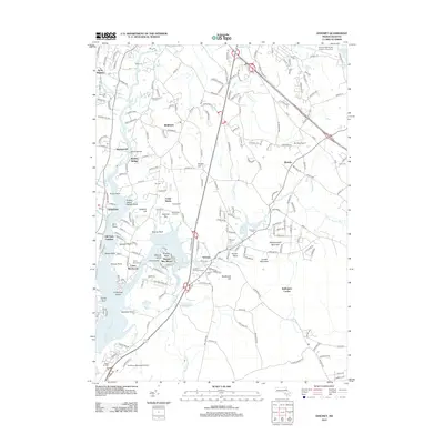
2012 Map of Assonet
USGS Topo · Published 2012About this map
The Taunton River and its various tributaries, including the Assonet River and Cotley River, dominate this coastal Massachusetts landscape. The map highlights the intricate geography of the shoreline, defined by numerous points and necks such as Assonet Neck, Shoves Neck, and Peters Point. Inland, the terrain is marked by distinctive elevations like Whippoorwill Mountain and Profile Rock. Several small airports, including Myricks Airport and Taunton Municipal Airport - King Field, reflect the regional aviation infrastructure.
Find a feature on this map
191 named features on this map. Tap any name to fly to it.
Don’t see what you’re looking for? This feature index may not catch every label — zoom into the map to look around manually.
Map Details
Editions of this 2012 Assonet Map
This is the sole edition of this map. No revisions or reprints were ever made.
Other maps of this area

1885 · New Bedford
USGS Topo · 1:62,500

1885 · Middleboro
USGS Topo · 1:62,500

1885 · Taunton
USGS Topo · 1:62,500

1888 · New Bedford
USGS Topo · 1:62,500

1888 · Fall River
USGS Topo · 1:62,500

1888 · Taunton
USGS Topo · 1:62,500

1888 · Middleboro
USGS Topo · 1:62,500

1893 · Taunton
USGS Topo · 1:62,500

1893 · Middleboro
USGS Topo · 1:62,500

1893 · Fall River
USGS Topo · 1:62,500