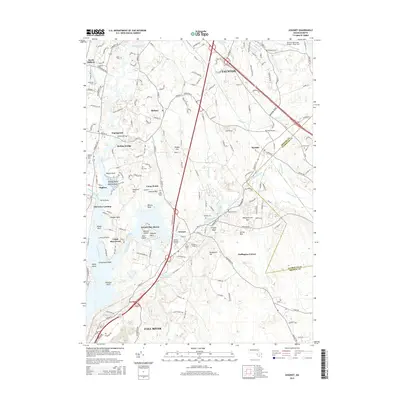
2015 Map of Assonet
USGS Topo · Published 2015About this map
The Taunton River serves as the central artery of this region, shaping the development of riverfront settlements like Dighton and North Dighton. The landscape is defined by the winding course of the Assonet River and its entry into Assonet Bay, where distinctive landforms such as Assonet Neck, Shoves Neck, and the legendary Dighton Rock reflect a long history of maritime and shoreline activity. In the interior, the terrain rises toward Bryant Hill and Whippoorwill Mtn, punctuated by notable outcrops like Profile Rock.
Find a feature on this map
174 named features on this map. Tap any name to fly to it.
Don’t see what you’re looking for? This feature index may not catch every label — zoom into the map to look around manually.
Map Details
Editions of this 2015 Assonet Map
This is the sole edition of this map. No revisions or reprints were ever made.
Other maps of this area

1885 · New Bedford
USGS Topo · 1:62,500

1885 · Middleboro
USGS Topo · 1:62,500

1885 · Taunton
USGS Topo · 1:62,500

1888 · New Bedford
USGS Topo · 1:62,500

1888 · Fall River
USGS Topo · 1:62,500

1888 · Taunton
USGS Topo · 1:62,500

1888 · Middleboro
USGS Topo · 1:62,500

1893 · Taunton
USGS Topo · 1:62,500

1893 · Middleboro
USGS Topo · 1:62,500

1893 · Fall River
USGS Topo · 1:62,500