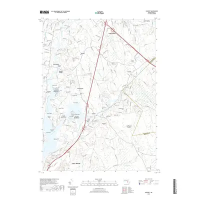
2018 Map of Assonet
USGS Topo · Published 2018About this map
The Taunton River and its major tributaries, the Assonet River and Segreganset River, define this coastal Massachusetts landscape. Notable for its dense concentration of genealogical landmarks, the area contains numerous historical burial sites such as the Assonet Burying Ground, Richmond Cem, and the Assonet Friends Cem. The map illustrates a developed transport and recreation network, featuring the Old Colony RR corridor and established seasonal sites like Camp Welch and Camp Merriwood.
Find a feature on this map
190 named features on this map. Tap any name to fly to it.
Don’t see what you’re looking for? This feature index may not catch every label — zoom into the map to look around manually.
Map Details
Editions of this 2018 Assonet Map
This is the sole edition of this map. No revisions or reprints were ever made.
Other maps of this area

1885 · New Bedford
USGS Topo · 1:62,500

1885 · Middleboro
USGS Topo · 1:62,500

1885 · Taunton
USGS Topo · 1:62,500

1888 · New Bedford
USGS Topo · 1:62,500

1888 · Fall River
USGS Topo · 1:62,500

1888 · Taunton
USGS Topo · 1:62,500

1888 · Middleboro
USGS Topo · 1:62,500

1893 · Taunton
USGS Topo · 1:62,500

1893 · Middleboro
USGS Topo · 1:62,500

1893 · Fall River
USGS Topo · 1:62,500