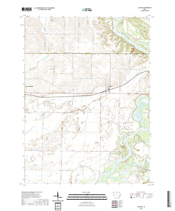
2022 Map of Atalissa
USGS Topo · Published 2022About this map
The Cedar River meanders across the eastern portion of this landscape, carving a wide valley through the Cedar and Muscatine County borderlands. Agriculture dominates the terrain, evidenced by a network of drainage infrastructure like Goshen Ditch, Wales Ditch, and the southern Pike Run. The community of Atalissa sits centrally along the rail corridor, while West Liberty occupies the western edge, showing the established settlement patterns of this Iowa prairie region.
Find a feature on this map
65 named features on this map. Tap any name to fly to it.
Don’t see what you’re looking for? This feature index may not catch every label — zoom into the map to look around manually.
Map Details
Editions of this 2022 Atalissa Map
This is the sole edition of this map. No revisions or reprints were ever made.
Other maps of this area

1891 · Wilton Junction
USGS Topo · 1:62,500

1894 · West Liberty
USGS Topo · 1:62,500

1901 · Stanwood
USGS Topo · 1:125,000

1948 · Muscatine
USGS Topo · 1:62,500

1953 · Wilton Junction
USGS Topo · 1:24,000
1953 · Muscatine
USGS Topo · 1:24,000
1953 · Lime City
USGS Topo · 1:24,000

1958 · Davenport
USGS Topo · 1:250,000

1961 · Davenport
USGS Topo · 1:250,000

1962 · Davenport
USGS Topo · 1:250,000