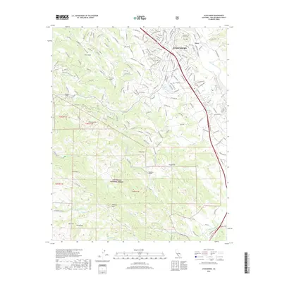
2018 Map of Atascadero
USGS Topo · Published 2018About this map
The city of Atascadero serves as the central hub of this 2018 survey, where the historic El Camino Real corridor meets a network of local roads including Pueblo Ave and Curbaril Ave. To the west, the landscape rises sharply into the protected lands of the Los Padres National Forest, a terrain of high points like Eagle Peak and Tassajera Peak. The map captures the transition from the structured residential blocks near Atascadero Lake to the more dispersed settlements of Paradise Valley and Henry further north.
Find a feature on this map
181 named features on this map. Tap any name to fly to it.
Don’t see what you’re looking for? This feature index may not catch every label — zoom into the map to look around manually.
Map Details
Editions of this 2018 Atascadero Map
This is the sole edition of this map. No revisions or reprints were ever made.
Other maps of this area

1897 · San Luis Obispo
USGS Topo · 1:62,500

1897 · Cayucos
USGS Topo · 1:62,500

1900 · San Luis
USGS Topo · 1:125,000

1919 · Paso Robles
USGS Topo · 1:62,500

1919 · Adelaida
USGS Topo · 1:62,500

1932 · Adelaida
USGS Topo · 1:62,500

1937 · Cayucos
USGS Topo · 1:62,500

1942 · Adelaida
USGS Topo · 1:62,500

1942 · San Luis Obispo
USGS Topo · 1:62,500

1943 · Paso Robles
USGS Topo · 1:62,500