2021 Map of Atascadero
USGS Topo · Published 2021About this map
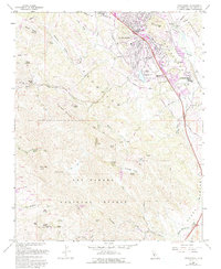
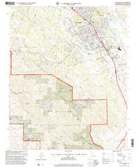
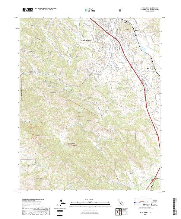
Atascadero serves as the focal point of this 2021 landscape, where the residential grids of the community meet the steep eastern slopes of the Santa Lucia Range. The map illustrates a transition from the suburban corridors along El Camino Real to the protected wilderness of the Los Padres National Forest. High points such as Tassajera Peak and Eagle Peak define the southern terrain, while the Salinas River carves its path through the northeastern corner near the small settlement of Henry. Local landmarks like Atascadero Lake and the Atascadero Pine Mountain Cem are clearly marked, providing essential points of reference for genealogists tracing family locations. The intricate network of canyons and valleys, including Kathleen Valley and Paradise Valley, reveals how the area’s rugged topography has influenced its modern development and road systems.
Find a feature on this map
155 named features on this map. Tap any name to fly to it.
Don’t see what you’re looking for? This feature index may not catch every label — zoom into the map to look around manually.
Map Details
Editions of this 2021 Atascadero Map
This is the sole edition of this map. No revisions or reprints were ever made.
Historical Maps of Morro Toro Through Time
3 maps found