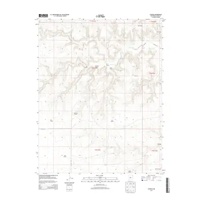
2013 Map of Atencio
USGS Topo · Published 2013About this map
Atencio sits on the eastern edge of this high-plains landscape, where the drainage of Carrizozo Cr cuts through a series of deep limestone and sandstone breaks. The terrain is defined by a network of significant canyons, including the prominent Rodríguez Canyon, Carl Canyon, and Box Canyon, which reflect the erosive power of seasonal water moving toward the New Mexico-Oklahoma borderlands. These geographical features dictated the placement of early ranching infrastructure and remote roadways such as CO Highway B-044.
Find a feature on this map
21 named features on this map. Tap any name to fly to it.
Don’t see what you’re looking for? This feature index may not catch every label — zoom into the map to look around manually.
Map Details
Editions of this 2013 Atencio Map
This is the sole edition of this map. No revisions or reprints were ever made.
Other maps of this area

1954 · Dalhart
USGS Topo · 1:250,000

1958 · Dalhart
USGS Topo · 1:250,000

1962 · Dalhart
USGS Topo · 1:250,000

1972 · Seneca
USGS Topo · 1:24,000

1972 · Mc Laughlin Bridge
USGS Topo · 1:24,000
1972 · Wedding Cake Butte
USGS Topo · 1:24,000

1972 · Cuates School
USGS Topo · 1:24,000
1972 · Goodson School
USGS Topo · 1:24,000

1972 · Atencio
USGS Topo · 1:24,000

1972 · Moses
USGS Topo · 1:24,000