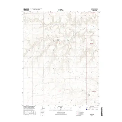
2017 Map of Atencio
USGS Topo · Published 2017About this map
Atencio sits in the high plateau country of northeast New Mexico, where the plains give way to a complex network of breaks and drainages. The landscape is defined by the east-flowing Carrizozo Creek, which carves through the terrain beneath the prominent Piñon Ridge. This area, characterized by its ranching history and sparse population, is etched with numerous named canyons such as Box Canyon, Rodriguez Canyon, and Carl Canyon, each reflecting the geographic orientation required for navigating this varied topography.
Find a feature on this map
20 named features on this map. Tap any name to fly to it.
Don’t see what you’re looking for? This feature index may not catch every label — zoom into the map to look around manually.
Map Details
Editions of this 2017 Atencio Map
This is the sole edition of this map. No revisions or reprints were ever made.
Other maps of this area

1954 · Dalhart
USGS Topo · 1:250,000

1958 · Dalhart
USGS Topo · 1:250,000

1962 · Dalhart
USGS Topo · 1:250,000

1972 · Seneca
USGS Topo · 1:24,000

1972 · Mc Laughlin Bridge
USGS Topo · 1:24,000
1972 · Wedding Cake Butte
USGS Topo · 1:24,000

1972 · Cuates School
USGS Topo · 1:24,000
1972 · Goodson School
USGS Topo · 1:24,000

1972 · Atencio
USGS Topo · 1:24,000

1972 · Moses
USGS Topo · 1:24,000