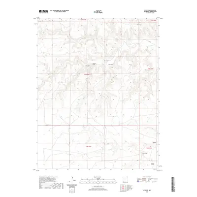
2020 Map of Atencio
USGS Topo · Published 2020About this map
Atencio sits at the base of a high plateau in northeastern New Mexico, where the plains give way to a deeply incised landscape of mesas and drainages. The topography is defined by the winding course of Carrizozo Creek, which flows past the prominent Piñon Ridge. This 2020 survey illustrates a sparsely populated ranching environment where movement is dictated by the natural breaks in the terrain. A network of named canyons, including Rodriguez Canyon, Carl Canyon, and Trujillo Canyon, carved into the earth by seasonal runoff, reveal the geographic constraints on local settlement. These landforms, along with routes like Cuates Rd and Co Rd B044, show the persistent relationship between the high desert environment and the human infrastructure required to navigate this portion of Union County.
Find a feature on this map
19 named features on this map. Tap any name to fly to it.
Don’t see what you’re looking for? This feature index may not catch every label — zoom into the map to look around manually.
Map Details
Editions of this 2020 Atencio Map
This is the sole edition of this map. No revisions or reprints were ever made.
Other maps of this area

1954 · Dalhart
USGS Topo · 1:250,000

1958 · Dalhart
USGS Topo · 1:250,000

1962 · Dalhart
USGS Topo · 1:250,000

1972 · Seneca
USGS Topo · 1:24,000

1972 · Mc Laughlin Bridge
USGS Topo · 1:24,000
1972 · Wedding Cake Butte
USGS Topo · 1:24,000

1972 · Cuates School
USGS Topo · 1:24,000
1972 · Goodson School
USGS Topo · 1:24,000

1972 · Atencio
USGS Topo · 1:24,000

1972 · Moses
USGS Topo · 1:24,000