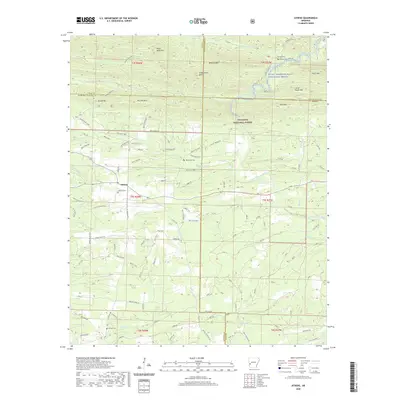
2020 Map of Athens
USGS Topo · Published 2020About this map
The settlement of Athens serves as a central point in this part of the Ouachita National Forest, situated where the hills meet the headwaters of several key Arkansas waterways. The landscape is defined by the sharp ridges of Brush Heap Mtn, Fodderstack Mtn, and Blaylock Mtn, which frame the descent of the Little Missouri River. A notable portion of this river is designated as the Little Missouri Wild and Scenic River, reflecting its protected status within the forest. Genealogists will find several burial sites scattered across the ridges and valleys, including Athens Cem, Brushy Cem, and the remote Putman Cem. The map documents a complex network of timber and forest roads, such as WEYCO Road 53800, which weave through the drainage basins of White Oak Cr and Brushy Cr, illustrating the ongoing intersection of public land management and local industry.
Find a feature on this map
75 named features on this map. Tap any name to fly to it.
Don’t see what you’re looking for? This feature index may not catch every label — zoom into the map to look around manually.
Map Details
Editions of this 2020 Athens Map
This is the sole edition of this map. No revisions or reprints were ever made.
Other maps of this area

1906 · Caddo Gap
USGS Topo · 1:125,000

1913 · De Queen
USGS Topo · 1:125,000

1936 · Athens
USGS Topo · 1:48,000

1942 · Athens
USGS Topo · 1:62,500

1950 · Mcalester
USGS Topo · 1:250,000

1955 · Little Rock
USGS Topo · 1:250,000

1956 · Little Rock
USGS Topo · 1:250,000

1959 · Umpire
USGS Topo · 1:62,500

1960 · Little Rock
USGS Topo · 1:250,000

1962 · McAlester
USGS Topo · 1:250,000