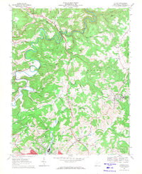
1968 Map of Athens
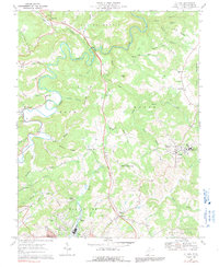
USGS Topo · Published 1971About this map
Concord College serves as a prominent landmark in the town of Athens, situated on the eastern heights above the winding Bluestone River. This late-1960s landscape is defined by its ridge-and-valley structure, where settlements like Speedway and Gardner are connected by the historic corridor of the Virginia Toll Road. The area demonstrates a transition from the academic and residential character of the college town to the industrial and transit-focused southern zone near Princeton, where the Norfolk and Western railroad follows the path of Brush Creek.
Find a feature on this map
61 named features on this map. Tap any name to fly to it.
Don’t see what you’re looking for? This feature index may not catch every label — zoom into the map to look around manually.
Map Details
Editions of this 1968 Athens Map
2 editions found
Other maps of this area

1887 · Pocahontas
USGS Topo · 1:125,000

1887 · Hinton
USGS Topo · 1:125,000

1890 · Dublin
USGS Topo · 1:125,000

1891 · Pocahontas
USGS Topo · 1:125,000

1891 · Dublin
USGS Topo · 1:125,000

1891 · Raleigh
USGS Topo · 1:125,000

1892 · Hinton
USGS Topo · 1:125,000

1894 · Pocahontas
USGS Topo · 1:125,000

1895 · Pocahontas
USGS Topo · 1:125,000

1897 · Raleigh
USGS Topo · 1:125,000