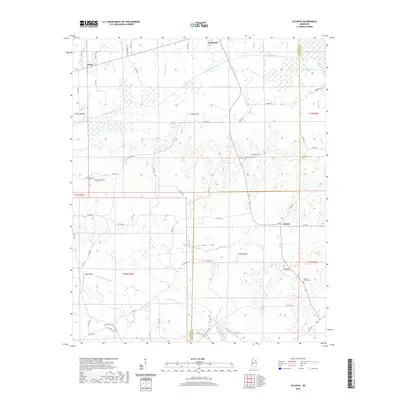
2020 Map of Atlanta
USGS Topo · Published 2020About this map
The Yalobusha River and Topashaw Cr Canal dominate the drainage of this Mississippi landscape along the border of Calhoun and Chickasaw counties. Small rural settlements like Atlanta, Vardaman, and Hollis anchor the community, connected by a network of county roads including Co RD 131 and HWY 341 S. The map provides significant genealogical value through its many recorded burial grounds, such as Old Providence Cem, Old Pleasant Grove Cem, and Bentley Cem, which are scattered throughout the agricultural and forested terrain. The presence of the Topashaw Cr Canal and smaller tributaries like Bear Cr and Meridian Cr illustrates the managed water systems necessary for the local agricultural economy. Features like Wade Field further emphasize the land's transition between natural waterways and productive rural acreage during the early twenty-first century.
Find a feature on this map
64 named features on this map. Tap any name to fly to it.
Don’t see what you’re looking for? This feature index may not catch every label — zoom into the map to look around manually.
Map Details
Editions of this 2020 Atlanta Map
This is the sole edition of this map. No revisions or reprints were ever made.
Other maps of this area

1953 · Walthall
USGS Topo · 1:62,500

1953 · West Point
USGS Topo · 1:250,000

1954 · Pittsboro
USGS Topo · 1:62,500

1958 · West Point
USGS Topo · 1:250,000

1963 · West Point
USGS Topo · 1:250,000

1972 · Atlanta
USGS Topo · 1:24,000

1972 · Vardaman
USGS Topo · 1:24,000

1972 · Hohenlinden
USGS Topo · 1:24,000
1972 · Houston West
USGS Topo · 1:24,000

1972 · Mantee
USGS Topo · 1:24,000