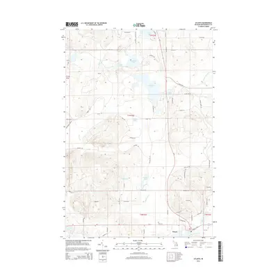
2014 Map of Atlanta
USGS Topo · Published 2014About this map
Atlanta serves as the focal point of this northern Michigan landscape, situated at the confluence of several key waterways and travel routes. The Thunder Bay River winds through the southern portion of the quadrangle, which is characterized by a dense network of glacial lakes including Muskellunge Lake, Valentine Lake, and Jackson Lake. This 2014 survey reveals a transition from the structured residential blocks of the settlement to a wilderness-oriented grid of forest trails and county roads, such as Co Road 624 and Scenic Route 2. Historical researchers can identify the Briley Cem located just east of the main town center, while naturalists can trace the paths of Canada Creek and Packer Cr as they navigate the varied topography of Briley Township. The abundance of named water bodies, from Pug Lakes to De Cheau Lake, underscores the region's character as a lake-country hub.
Find a feature on this map
72 named features on this map. Tap any name to fly to it.
Don’t see what you’re looking for? This feature index may not catch every label — zoom into the map to look around manually.
Map Details
Editions of this 2014 Atlanta Map
This is the sole edition of this map. No revisions or reprints were ever made.
Other maps of this area

1949 · Lewiston
USGS Topo · 1:62,500

1950 · Lewiston
USGS Topo · 1:24,000

1951 · Lewiston
USGS Topo · 1:24,000

1954 · Hetherton
USGS Topo · 1:62,500

1954 · Traverse City
USGS Topo · 1:250,000

1955 · Atlanta
USGS Topo · 1:62,500

1955 · Comins
USGS Topo · 1:62,500

1955 · Cheboygan
USGS Topo · 1:250,000

1958 · Cheboygan
USGS Topo · 1:250,000

1958 · Traverse City
USGS Topo · 1:250,000