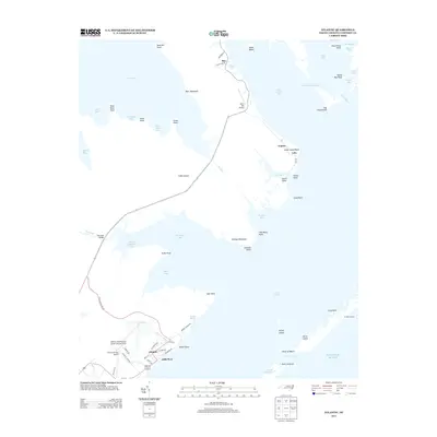
2013 Map of Atlantic
USGS Topo · Published 2013About this map
Core Sound and the intricate wetlands of eastern North Carolina define this coastal landscape, where life follows the edges of Cedar Island and the mainland. Small maritime communities like Atlantic, Roe, and Lola are linked by a network of winding roads and bridges, including the Thorofare Bridge. The area's reliance on both water and air travel is evident in the presence of Morris Marina alongside the Wolf's Den Airport and the Atlantic Field Marine Corps Outlying Field. This 2013 survey documents a landscape of shifting sands and tidal passages, where named features like John Ditch and the Great Ditch illustrate long-standing efforts to navigate and manage the marshy terrain. From the secluded Ira Morris Camp on the outer banks to the residential clusters of Little Port, the map captures the late modern character of these isolated fishing and military outposts.
Find a feature on this map
74 named features on this map. Tap any name to fly to it.
Don’t see what you’re looking for? This feature index may not catch every label — zoom into the map to look around manually.
Map Details
Editions of this 2013 Atlantic Map
This is the sole edition of this map. No revisions or reprints were ever made.
Other maps of this area

1948 · North Bay
USGS Topo · 1:24,000

1949 · Atlantic
USGS Topo · 1:24,000

1949 · Styron Bay
USGS Topo · 1:24,000

1949 · Point Of Marsh
USGS Topo · 1:24,000

1949 · Long Bay
USGS Topo · 1:24,000

1949 · Davis
USGS Topo · 1:24,000

1950 · Long Bay
USGS Topo · 1:24,000

1950 · North Bay
USGS Topo · 1:24,000

1950 · Point Of Marsh
USGS Topo · 1:24,000
1951 · Atlantic
USGS Topo · 1:24,000