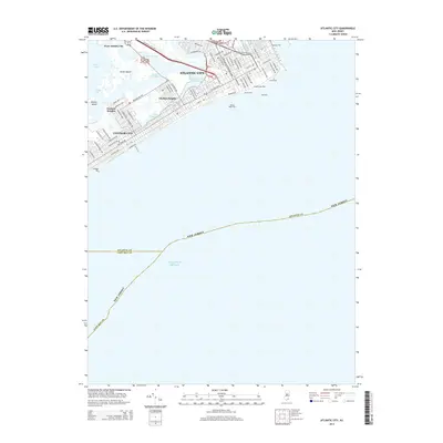
2014 Map of Atlantic City
USGS Topo · Published 2014About this map
Atlantic City and the neighboring Ventnor City occupy the northern end of the barrier island, characterized by an intensive urban grid defined by Arctic Ave, Atlantic Ave, and Pacific Ave. The 2014 survey documents the dense shoreline development and its famous amusement piers extending into the Atlantic Ocean, including the Steel Pier, Central Pier, and the Million Dollar Pier. To the west, the landscape transitions into the tidal complex of Lakes Bay and Great Island, where the Intracoastal Waterway threads through a network of tidal channels known as thorofares. Residential expansion is visible in the satellite-style settlements of Chelsea Heights and Ventnor Heights, which are separated from the main island by the Inside Thorofare. The map also captures the transport corridors of the Atlantic City Expy and Absecon Blvd connecting the mainland at West Atlantic City to the coastal resorts.
Find a feature on this map
76 named features on this map. Tap any name to fly to it.
Don’t see what you’re looking for? This feature index may not catch every label — zoom into the map to look around manually.
Map Details
Editions of this 2014 Atlantic City Map
This is the sole edition of this map. No revisions or reprints were ever made.
Other maps of this area

1884 · Sea Isle
USGS Topo · 1:62,500

1887 · Atlantic City
USGS Topo · 1:62,500

1888 · Sea Isle
USGS Topo · 1:62,500

1890 · Great Egg Harbor
USGS Topo · 1:62,500

1893 · Great Egg Harbor
USGS Topo · 1:62,500

1894 · Sea Isle
USGS Topo · 1:62,500

1894 · Atlantic City
USGS Topo · 1:62,500

1918 · Great Egg Harbor
USGS Topo · 1:62,500

1919 · Sea Isle
USGS Topo · 1:62,500

1940 · Atlantic City
USGS Topo · 1:62,500