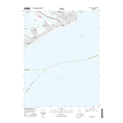
2016 Map of Atlantic City
USGS Topo · Published 2016About this map
The dense grid of Atlantic City sits atop a complex geography of tidal wetlands and thoroughfares, connected to the mainland via the Atlantic City Expressway and Absecon Blvd. This 2016 survey illustrates the modern configuration of the barrier island, where the urban core transitions into established residential neighborhoods like Chelsea Heights and Ventnor Heights. The land is defined by a network of waterways including the Intracoastal Waterway and various passages such as Great Thorofare and Inside Thorofare, which separate the main island from Great Island and Shelter Island. Street-level detail is extensive, particularly in the northern reaches of the city where avenues named for states, such as N Indiana Ave and N Kentucky Ave, meet cross-streets like Adriatic Ave and Caspian Ave, showcasing the enduring 19th-century planning that still dictates the modern resort town.
Find a feature on this map
91 named features on this map. Tap any name to fly to it.
Don’t see what you’re looking for? This feature index may not catch every label — zoom into the map to look around manually.
Map Details
Editions of this 2016 Atlantic City Map
This is the sole edition of this map. No revisions or reprints were ever made.
Other maps of this area

1884 · Sea Isle
USGS Topo · 1:62,500

1887 · Atlantic City
USGS Topo · 1:62,500

1888 · Sea Isle
USGS Topo · 1:62,500

1890 · Great Egg Harbor
USGS Topo · 1:62,500

1893 · Great Egg Harbor
USGS Topo · 1:62,500

1894 · Sea Isle
USGS Topo · 1:62,500

1894 · Atlantic City
USGS Topo · 1:62,500

1918 · Great Egg Harbor
USGS Topo · 1:62,500

1919 · Sea Isle
USGS Topo · 1:62,500

1940 · Atlantic City
USGS Topo · 1:62,500