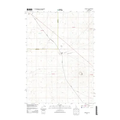
2013 Map of Atomic City
USGS Topo · Published 2013About this map
Atomic City sits at the heart of this high-desert landscape on the boundary of Butte and Bingham counties. The town's grid, featuring 2nd W St, provides a small hub of human settlement amidst a terrain defined by subtle geological features and expansive grazing lands. Notable landforms like Table Legs Butte and Ryegrass Flat punctuate the area, while the Cottontail Waterhole offers a rare named water source in this arid environment. The transportation network is anchored by several rural routes including Taber Rd and the Main Road to Highway 26. Aviation history is represented by Midway Airport, a remote landing strip located northwest of the town center. This survey illustrates the spatial relationship between the isolated community and the surrounding land used for grazing and transit in the early twenty-first century.
Find a feature on this map
20 named features on this map. Tap any name to fly to it.
Don’t see what you’re looking for? This feature index may not catch every label — zoom into the map to look around manually.
Map Details
Editions of this 2013 Atomic City Map
This is the sole edition of this map. No revisions or reprints were ever made.
Other maps of this area

1955 · Idaho Falls
USGS Topo · 1:250,000

1958 · Idaho Falls
USGS Topo · 1:250,000

1973 · Scoville
USGS Topo · 1:24,000

1973 · Middle Butte
USGS Topo · 1:24,000

1973 · Taber
USGS Topo · 1:24,000

1973 · Rock Butte
USGS Topo · 1:24,000

1973 · Atomic City
USGS Topo · 1:24,000

1973 · Lava Lake Reservoir
USGS Topo · 1:24,000

1973 · Circular Butte 3 SW
USGS Topo · 1:24,000

1973 · Circular Butte 3 SE
USGS Topo · 1:24,000