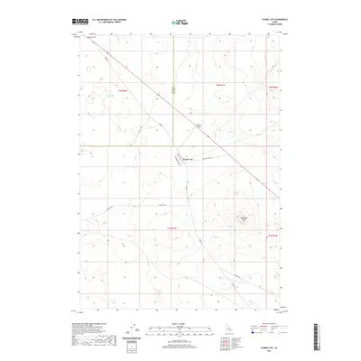
2020 Map of Atomic City
USGS Topo · Published 2020About this map
Atomic City sits at the intersection of high-desert infrastructure and the volcanic topography of the Snake River Plain. This 2020 survey by the U.S. Geological Survey highlights the small settlement’s layout, featuring streets like Second West St and the Main Rd to Hwy 26. The surrounding landscape is defined by its arid character and geologic formations, most notably Table Legs Butte to the southeast and the wide expanse of Ryegrass Flat. The presence of the Midway Airport and the isolated Cottontail Waterhole reflects the logistical challenges of this remote region. Transportation corridors like Taber Rd and Big Butte Rd provide the primary links across the expansive township and range lines of Butte and Bingham Counties.
Find a feature on this map
19 named features on this map. Tap any name to fly to it.
Don’t see what you’re looking for? This feature index may not catch every label — zoom into the map to look around manually.
Map Details
Editions of this 2020 Atomic City Map
This is the sole edition of this map. No revisions or reprints were ever made.
Other maps of this area

1955 · Idaho Falls
USGS Topo · 1:250,000

1958 · Idaho Falls
USGS Topo · 1:250,000

1973 · Scoville
USGS Topo · 1:24,000

1973 · Middle Butte
USGS Topo · 1:24,000

1973 · Taber
USGS Topo · 1:24,000

1973 · Rock Butte
USGS Topo · 1:24,000

1973 · Atomic City
USGS Topo · 1:24,000

1973 · Lava Lake Reservoir
USGS Topo · 1:24,000

1973 · Circular Butte 3 SW
USGS Topo · 1:24,000

1973 · Circular Butte 3 SE
USGS Topo · 1:24,000