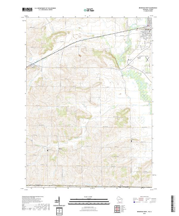
2022 Map of Attica
USGS Topo · Published 2022About this map
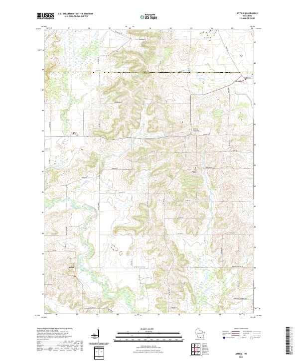
The border of Green and Dane counties reveals a landscape defined by the winding course of the Sugar River and its numerous tributaries. In the village of Brooklyn, the street grid centers around W Main St, while the community of Attica sits further southwest along the riverbank. This rural expanse is characterized by prominent elevation points like Liberty Pole Hill and the quiet seclusion of Jug Prairie Cem near the center of the quadrangle. The drainage network is particularly dense here, with Allen Creek, Gill Creek, and Liberty Creek carving through the agricultural terrain. Long-established family and farm-to-market routes such as Tipperary Rd, Zweifel Rd, and Sandy Hook Rd illustrate the local transportation patterns that have connected these dairy-country settlements for generations.
Find a feature on this map
52 named features on this map. Tap any name to fly to it.
Don’t see what you’re looking for? This feature index may not catch every label — zoom into the map to look around manually.
Map Details
Editions of this 2022 Attica Map
This is the sole edition of this map. No revisions or reprints were ever made.
Historical Maps of Montrose Through Time
6 maps found