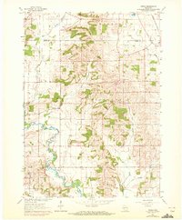
1961 Map of Attica
USGS Topo · Published 1972About this map
The Sugar River meanders through the heart of the Green and Dane county line in this early 1960s study, its winding path defining the rural boundary between the townships of Exeter and Albany. The landscape is a patchwork of agricultural land and wooded slopes, centered on significant elevations like Liberty Pole Hill. Cultural markers of the era are well-documented, from the Chicago and North Western railroad corridor passing through Brooklyn to the distribution of local schools and churches. Genealogists will find several distinct burial grounds, including the Oak Grove Cem and Joe Prairie Cem. The presence of multiple quarries and gravel pits suggests a mid-century economy tied to local mineral extraction and road building. This 1971 photorevision adds specific details to the 1961 base, documenting the subtle shifts in rural settlement patterns and property lines.
Find a feature on this map
28 named features on this map. Tap any name to fly to it.
Don’t see what you’re looking for? This feature index may not catch every label — zoom into the map to look around manually.
Map Details
Editions of this 1961 Attica Map
2 editions found
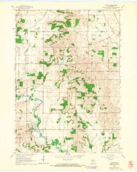
Other maps of this area

1889 · Evansville
USGS Topo · 1:62,500

1893 · Brodhead
USGS Topo · 1:62,500

1894 · Evansville
USGS Topo · 1:62,500

1906 · Evansville
USGS Topo · 1:62,500

1920 · Monroe
USGS Topo · 1:62,500

1922 · Monroe
USGS Topo · 1:62,500

1923 · New Glarus
USGS Topo · 1:62,500

1954 · Rockford
USGS Topo · 1:250,000

1955 · Rockford
USGS Topo · 1:250,000

1958 · Rockford
USGS Topo · 1:250,000