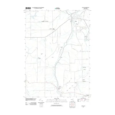
2010 Map of Attica
USGS Topo · Published 2010About this map
Tonawanda Creek carves a deep path through the center of this Wyoming County landscape, creating a corridor for both nature and infrastructure. The village of Attica serves as a primary hub in the north, while Varysburg anchors the southern reaches at the confluence of the creek and Stony Brook. Genealogists will find a high density of burial grounds throughout the area, including the East Bennington German Cemetery, Saint Vincent Cemetery, and the notable Prison Cemetery near the Attica Reservoir. The terrain is defined by dramatic elevation shifts, from the lowlands of the Konawaugus Valley to prominent heights like Poland Hill and Orr Hill. Smaller rural settlements such as Danley Corners and Sierks are linked by a network of established roads like Buffalo Rd and Exchange Rd, illustrating the enduring rural settlement patterns of Western New York.
Find a feature on this map
69 named features on this map. Tap any name to fly to it.
Don’t see what you’re looking for? This feature index may not catch every label — zoom into the map to look around manually.
Map Details
Editions of this 2010 Attica Map
This is the sole edition of this map. No revisions or reprints were ever made.
Other maps of this area

1904 · Batavia
USGS Topo · 1:62,500

1905 · Attica
USGS Topo · 1:62,500

1905 · Portage
USGS Topo · 1:62,500

1923 · Arcade
USGS Topo · 1:62,500

1925 · Arcade
USGS Topo · 1:62,500

1943 · Warsaw
USGS Topo · 1:24,000

1944 · Alexander
USGS Topo · 1:31,680

1944 · Warsaw
USGS Topo · 1:31,680

1949 · Attica
USGS Topo · 1:62,500

1949 · Alexander
USGS Topo · 1:24,000