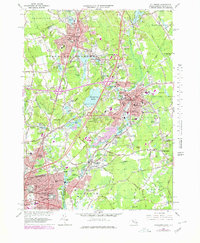
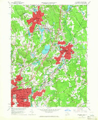
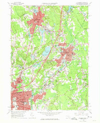
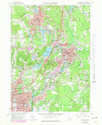
1964 Map of Attleboro
USGS Topo · Published 1979About this map
Attleboro and North Attleboro serve as the industrial and civic hubs of this Bristol County landscape, captured here in a 1964 survey with updates into the late 1970s. The region's development is defined by its transit corridors and water power, with the Tenmile River and Sevenmile River winding through established settlements like Dodgeville, Hebronville, and Attleboro Falls. The map reveals a dense network of institutional life, from the Sturdy Mem Hospital and Fuller Memorial Sanitarium to numerous parochial and public schools such as Bishop Feehan High Sch and St Martins Sch.
Find a feature on this map
119 named features on this map. Tap any name to fly to it.
Don’t see what you’re looking for? This feature index may not catch every label — zoom into the map to look around manually.
Map Details
Editions of this 1964 Attleboro Map
4 editions found
Other maps of this area

1885 · Taunton
USGS Topo · 1:62,500

1886 · Dedham
USGS Topo · 1:62,500

1887 · Franklin
USGS Topo · 1:62,500

1887 · Providence
USGS Topo · 1:62,500

1888 · Taunton
USGS Topo · 1:62,500

1889 · Providence
USGS Topo · 1:62,500

1889 · Franklin
USGS Topo · 1:62,500

1893 · Taunton
USGS Topo · 1:62,500

1893 · Franklin
USGS Topo · 1:62,500

1894 · Dedham
USGS Topo · 1:62,500