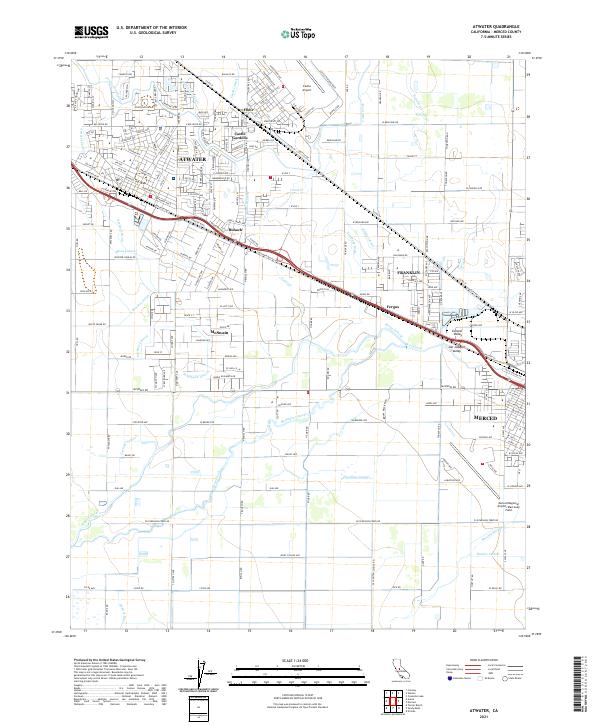
2021 Map of Atwater
USGS Topo · Published 2021About this map
Atwater and the surrounding Merced County landscape are defined by an intricate network of irrigation channels and agricultural settlements. The northern portion of the map is dominated by the former Castle Airforce Base, now serving as Castle Airport, with its distinctive taxiway and apron layout including roads named Zeppelin Dr and Convoy Rd. To the south and west, the terrain is partitioned by water features like the Livingston Canal and Atwater Canal, supporting smaller communities such as Buhach and McSwain. The presence of the Southern Pacific Ave rail corridor underscores the area's historical reliance on transportation for its agricultural output. This modern survey also captures the northern fringes of Merced, including the Merced Regional Airport/Macready Field and the meandering path of Bear Creek.
Find a feature on this map
218 named features on this map. Tap any name to fly to it.
Don’t see what you’re looking for? This feature index may not catch every label — zoom into the map to look around manually.
Map Details
Editions of this 2021 Atwater Map
This is the sole edition of this map. No revisions or reprints were ever made.
Other maps of this area

1914 · Merced
USGS Topo · 1:31,680

1916 · Hopeton
USGS Topo · 1:31,680

1916 · Cressey
USGS Topo · 1:31,680

1917 · Winton
USGS Topo · 1:31,680

1917 · Merced
USGS Topo · 1:31,680

1918 · Arena
USGS Topo · 1:31,680

1918 · Lingard
USGS Topo · 1:31,680

1918 · Atwater
USGS Topo · 1:31,680

1918 · Sandy Mush
USGS Topo · 1:31,680

1918 · Turner Ranch
USGS Topo · 1:31,680