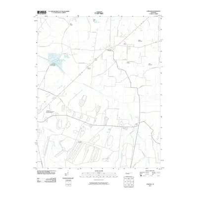
2010 Map of Atwood
USGS Topo · Published 2010About this map
The University of Tennessee Agricultural Experimental Farm occupies a significant portion of the landscape in this West Tennessee corridor, situated just southwest of the town of Atwood. This agricultural landscape is defined by the winding course of the Rutherford Fork Obion River and its numerous tributaries, including Wolf Creek and Sandy Branch. Small-scale water management is evident through features like Luckey Lake and Creswell Lake Number Thirty-one, while the local topography rises toward Webb Mountain and Clark Mountain.
Find a feature on this map
51 named features on this map. Tap any name to fly to it.
Don’t see what you’re looking for? This feature index may not catch every label — zoom into the map to look around manually.
Map Details
Editions of this 2010 Atwood Map
This is the sole edition of this map. No revisions or reprints were ever made.
Other maps of this area

1952 · Milan
USGS Topo · 1:24,000

1954 · Bradford
USGS Topo · 1:24,000

1956 · Dyersburg
USGS Topo · 1:250,000

1956 · Blytheville
USGS Topo · 1:250,000

1959 · Medina
USGS Topo · 1:24,000

1959 · Blytheville
USGS Topo · 1:250,000

1966 · Spring Creek
USGS Topo · 1:24,000

1966 · Mc Lemoresville
USGS Topo · 1:24,000

1966 · Atwood
USGS Topo · 1:24,000

1966 · Trezevant West
USGS Topo · 1:24,000