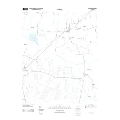
2013 Map of Atwood
USGS Topo · Published 2013About this map
The Rutherford Fork Obion River winds through this West Tennessee landscape, anchoring a rural network of small settlements and agricultural research. The town of Atwood serves as a central hub, surrounded by smaller communities including Ledbetter, Howse, and Whitthorne. To the southwest, the University of Tennessee Agricultural Experimental Farm highlights the area's long-standing connection to local land management and development.
Find a feature on this map
77 named features on this map. Tap any name to fly to it.
Don’t see what you’re looking for? This feature index may not catch every label — zoom into the map to look around manually.
Map Details
Editions of this 2013 Atwood Map
This is the sole edition of this map. No revisions or reprints were ever made.
Other maps of this area

1952 · Milan
USGS Topo · 1:24,000

1954 · Bradford
USGS Topo · 1:24,000

1956 · Dyersburg
USGS Topo · 1:250,000

1956 · Blytheville
USGS Topo · 1:250,000

1959 · Medina
USGS Topo · 1:24,000

1959 · Blytheville
USGS Topo · 1:250,000

1966 · Spring Creek
USGS Topo · 1:24,000

1966 · Mc Lemoresville
USGS Topo · 1:24,000

1966 · Atwood
USGS Topo · 1:24,000

1966 · Trezevant West
USGS Topo · 1:24,000