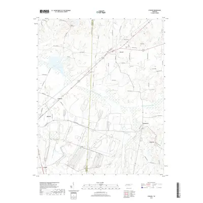
2019 Map of Atwood
USGS Topo · Published 2019About this map
The Rutherford Fork Obion River meanders across the center of this landscape, marking the boundary between rural Gibson and Carroll counties. The town of Atwood serves as a local hub, situated at the intersection of critical regional routes and the CSX Transportation railroad line. Small rural settlements like Whitthorne, Ledbetter, and the aptly named Graball are scattered throughout the agricultural terrain, often centered around family-named landmarks and local cemeteries such as Keaton Cem and Pisgah Cem. Rising above the bottomlands, Webb Mtn and Clark Mtn provide distinct topographic relief in an area otherwise defined by creek drainages like Wolf Cr and Sandy Br. The network of roads, including Flippen School House Rd and Cades Atwood Rd, reflects a long history of rural schooling and community connections that have defined West Tennessee for generations.
Find a feature on this map
77 named features on this map. Tap any name to fly to it.
Don’t see what you’re looking for? This feature index may not catch every label — zoom into the map to look around manually.
Map Details
Editions of this 2019 Atwood Map
This is the sole edition of this map. No revisions or reprints were ever made.
Other maps of this area

1952 · Milan
USGS Topo · 1:24,000

1954 · Bradford
USGS Topo · 1:24,000

1956 · Dyersburg
USGS Topo · 1:250,000

1956 · Blytheville
USGS Topo · 1:250,000

1959 · Medina
USGS Topo · 1:24,000

1959 · Blytheville
USGS Topo · 1:250,000

1966 · Spring Creek
USGS Topo · 1:24,000

1966 · Mc Lemoresville
USGS Topo · 1:24,000

1966 · Atwood
USGS Topo · 1:24,000

1966 · Trezevant West
USGS Topo · 1:24,000