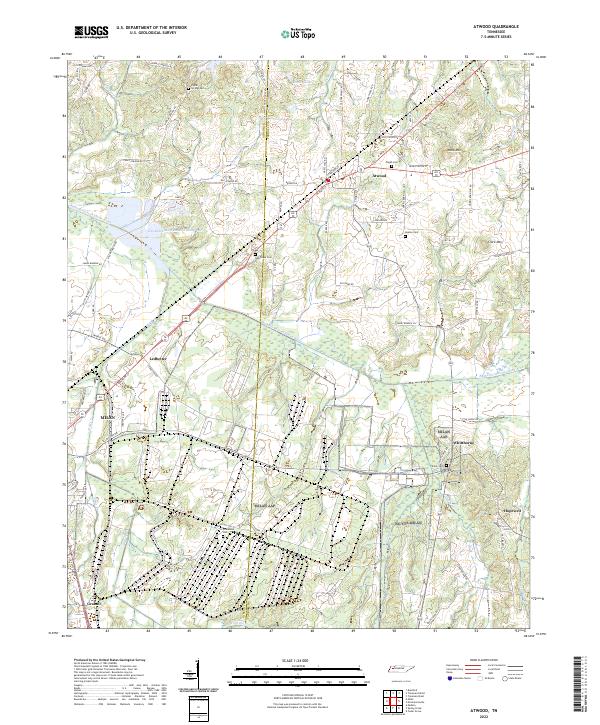
2022 Map of Atwood
USGS Topo · Published 2022About this map
The Rutherford Fork Obion River winds through the rural landscape of Gibson and Carroll counties, anchoring a network of small agricultural settlements and family landmarks. This 2022 survey documents the enduring community structures of West Tennessee, including the town of Atwood and smaller locales such as Whitthorne, Hopewell, and Ledbetter. The area is characterized by its numerous historic burial grounds, such as Poplar Springs Cem, Pisgah Cem, and Keaton Cem, which serve as vital points of reference for local genealogy.
Find a feature on this map
79 named features on this map. Tap any name to fly to it.
Don’t see what you’re looking for? This feature index may not catch every label — zoom into the map to look around manually.
Map Details
Editions of this 2022 Atwood Map
This is the sole edition of this map. No revisions or reprints were ever made.
Other maps of this area

1952 · Milan
USGS Topo · 1:24,000

1954 · Bradford
USGS Topo · 1:24,000

1956 · Dyersburg
USGS Topo · 1:250,000

1956 · Blytheville
USGS Topo · 1:250,000

1959 · Medina
USGS Topo · 1:24,000

1959 · Blytheville
USGS Topo · 1:250,000

1966 · Spring Creek
USGS Topo · 1:24,000

1966 · Mc Lemoresville
USGS Topo · 1:24,000

1966 · Atwood
USGS Topo · 1:24,000

1966 · Trezevant West
USGS Topo · 1:24,000