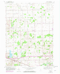
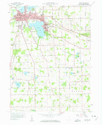
1959 Map of Atwood
USGS Topo · Published 1982About this map
The Atwood settlement and its surrounding agricultural landscape in Kosciusko County are defined by a complex drainage network including the Tippecanoe River and Hoffman Lake. This 1959 survey, updated with 1981 revisions, illustrates the rural development across townships like Scott, Jefferson, and Prairie. The map shows a transition from traditional rail-based commerce along the Conrail line to the prominence of the Lincoln Highway. Local genealogy is well-supported by numerous rural landmarks, such as Mt Tabor Ch, the Stony Point Ch, and family-named cemeteries including Graber Cem and Clunette Cem. Further north, the small hamlet of Clunette sits at a crossroads of named county routes, while the eastern edge follows the bends of the river near Pleasant View. A high density of named agricultural ditches, such as Fleugel Ditch and Pinkerton Ditch, reveals the intensive effort to manage this glaciated terrain for farming.
Find a feature on this map
55 named features on this map. Tap any name to fly to it.
Don’t see what you’re looking for? This feature index may not catch every label — zoom into the map to look around manually.
Map Details
Editions of this 1959 Atwood Map
Other maps of this area

1950 · Leesburg
USGS Topo · 1:24,000
1951 · Milford
USGS Topo · 1:24,000

1953 · Fort Wayne
USGS Topo · 1:250,000

1953 · Chicago
USGS Topo · 1:250,000

1956 · Fort Wayne
USGS Topo · 1:250,000

1957 · Chicago
USGS Topo · 1:250,000
1957 · Warsaw
USGS Topo · 1:24,000
1958 · Nappanee West
USGS Topo · 1:24,000
1958 · Nappanee East
USGS Topo · 1:24,000
1958 · Bourbon
USGS Topo · 1:24,000