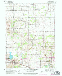
1959 Map of Atwood
USGS Topo · Published 1994About this map
Clunette serves as a central point in this northern Indiana landscape, where the agricultural grid is deeply etched by a complex network of drainage systems. Water management is the defining characteristic of this terrain, evidenced by numerous named waterways such as Dausman Ditch, Fleugel Ditch, and Truax Ditch that feed into the larger Tippecanoe River system. This 1959 survey, later updated with aerial observations, shows a region transitioning into the mid-century era, with rural schools and churches standing alongside newer developments like the Drive-in Theater near the southern boundary.
Find a feature on this map
51 named features on this map. Tap any name to fly to it.
Don’t see what you’re looking for? This feature index may not catch every label — zoom into the map to look around manually.
Map Details
Editions of this 1959 Atwood Map

Other maps of this area

1950 · Leesburg
USGS Topo · 1:24,000

1951 · Milford
USGS Topo · 1:24,000

1953 · Fort Wayne
USGS Topo · 1:250,000

1953 · Chicago
USGS Topo · 1:250,000

1956 · Fort Wayne
USGS Topo · 1:250,000

1957 · Chicago
USGS Topo · 1:250,000

1957 · Warsaw
USGS Topo · 1:24,000

1958 · Nappanee West
USGS Topo · 1:24,000

1958 · Nappanee East
USGS Topo · 1:24,000

1958 · Bourbon
USGS Topo · 1:24,000