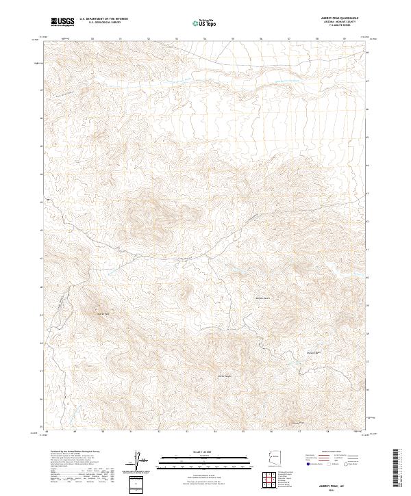
2021 Map of Aubrey Peak
USGS Topo · Published 2021About this map
Aubrey Peak dominates this high-desert landscape in Mohave County, where the eastern reaches of the Mojave Desert meet a complex network of seasonal drainage systems. The survey detail highlights the intricate topography of the Shannon Basin and the deep relief of Devils Canyon. Water management and natural transit are evidenced by the numerous washes that carve through the terrain, including Natural Corrals Wash to the north and Groom Spring Wash near Groom Peak to the south. Human footprint in this arid environment is limited primarily to the winding path of Chicken Springs Rd, which provides one of the few established routes through the mountainous sections. The map serves as a record of the hydrological patterns of the region, featuring Bronco Cr and Bronco Wash as they navigate the varying elevations.
Find a feature on this map
15 named features on this map. Tap any name to fly to it.
Don’t see what you’re looking for? This feature index may not catch every label — zoom into the map to look around manually.
Map Details
Editions of this 2021 Aubrey Peak Map
This is the sole edition of this map. No revisions or reprints were ever made.
Other maps of this area

1923 · Signal
USGS Topo · 1:250,000

1942 · Signal
USGS Topo · 1:250,000

1950 · Prescott
USGS Topo · 1:250,000

1954 · Prescott
USGS Topo · 1:250,000

1958 · Prescott
USGS Topo · 1:250,000

1959 · Prescott
USGS Topo · 1:250,000

1960 · Prescott
USGS Topo · 1:250,000

1965 · Prescott
USGS Topo · 1:250,000
1967 · Groom Spring
USGS Topo · 1:24,000
1967 · Dutch Flat SE
USGS Topo · 1:24,000