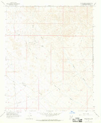
1967 Map of Groom Spring
USGS Topo · Published 1969About this map
Groom Spring and a network of ephemeral water sources define this arid landscape in Mohave County. In this high-desert environment, the survival of travelers and livestock once depended on reliably mapped watering holes such as Coyote Well, Coyote Tank, and Bonita Spring. The map documents a rugged drainage system where Groom Spring Wash and Graveyard Wash cut through the terrain, eventually feeding toward the deep incisions of Devils Canyon.
Find a feature on this map
11 named features on this map. Tap any name to fly to it.
Don’t see what you’re looking for? This feature index may not catch every label — zoom into the map to look around manually.
Map Details
Editions of this 1967 Groom Spring Map
2 editions found
Other maps of this area

1923 · Signal
USGS Topo · 1:250,000

1942 · Signal
USGS Topo · 1:250,000

1950 · Prescott
USGS Topo · 1:250,000

1954 · Prescott
USGS Topo · 1:250,000

1958 · Prescott
USGS Topo · 1:250,000

1959 · Prescott
USGS Topo · 1:250,000

1960 · Prescott
USGS Topo · 1:250,000

1965 · Prescott
USGS Topo · 1:250,000
1966 · Castaneda Hills
USGS Topo · 1:62,500

1966 · Artillery Peak
USGS Topo · 1:62,500