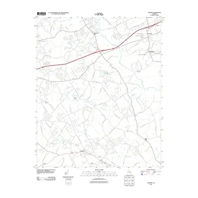
2011 Map of Auburn
USGS Topo · Published 2011About this map
Auburn and its neighboring towns of Carl, Hoschton, and Braselton anchor this 2011 survey, illustrating a landscape of increasing suburban connection. The Mulberry River and several of its tributaries, including Little Mulberry River and Rock Creek, define the drainage patterns across the region. Local heritage is preserved through numerous family and community burial grounds, such as Bethlehem Cemetery, Carl Cemetery, and Helton Cemetery, which are often located near long-standing intersections like Duncan Cross Roads.
Find a feature on this map
85 named features on this map. Tap any name to fly to it.
Don’t see what you’re looking for? This feature index may not catch every label — zoom into the map to look around manually.
Map Details
Editions of this 2011 Auburn Map
This is the sole edition of this map. No revisions or reprints were ever made.
Other maps of this area

1891 · Gainesville
USGS Topo · 1:125,000

1896 · Monroe
USGS Topo · 1:125,000

1953 · Athens
USGS Topo · 1:250,000

1954 · Greenville
USGS Topo · 1:250,000

1958 · Greenville
USGS Topo · 1:250,000

1958 · Athens
USGS Topo · 1:250,000

1959 · Athens
USGS Topo · 1:250,000

1963 · Athens
USGS Topo · 1:250,000

1964 · Hog Mountain
USGS Topo · 1:24,000

1964 · Chestnut Mountain
USGS Topo · 1:24,000