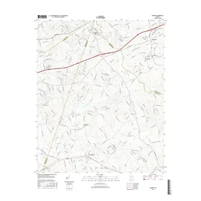
2017 Map of Auburn
USGS Topo · Published 2017About this map
Auburn and Carl anchor the southern portion of this modern survey, marking a corridor of growth where the borders of Gwinnett and Barrow counties meet. The landscape is defined by the drainage systems of the Mulberry River and Little Mulberry River, which flow across a terrain punctuated by Doe Ridge and Pool Mtn. Notable for local historians are several long-established community centers, including the Harmony Grove United Methodist Church and its accompanying Harmony Grove United Methodist Church Cem. Further north, the proximity of Braselton and Hoschton highlights the clustering of historic municipalities along the Piedmont's evolving transportation routes. Water resources like Cruce Lake, Oglesby Lake, and the headwaters of the Apalachee River illustrate the hydrology that influenced early settlement patterns near Thompsons Mill.
Find a feature on this map
223 named features on this map. Tap any name to fly to it.
Don’t see what you’re looking for? This feature index may not catch every label — zoom into the map to look around manually.
Map Details
Editions of this 2017 Auburn Map
This is the sole edition of this map. No revisions or reprints were ever made.
Other maps of this area

1891 · Gainesville
USGS Topo · 1:125,000

1896 · Monroe
USGS Topo · 1:125,000

1953 · Athens
USGS Topo · 1:250,000

1954 · Greenville
USGS Topo · 1:250,000

1958 · Greenville
USGS Topo · 1:250,000

1958 · Athens
USGS Topo · 1:250,000

1959 · Athens
USGS Topo · 1:250,000

1963 · Athens
USGS Topo · 1:250,000

1964 · Hog Mountain
USGS Topo · 1:24,000

1964 · Chestnut Mountain
USGS Topo · 1:24,000