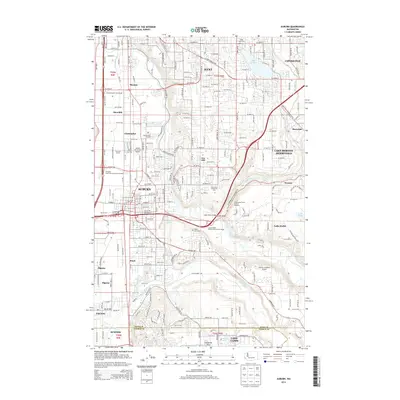
2014 Map of Auburn
USGS Topo · Published 2014About this map
The Green River carves a deep valley through this 2014 landscape, defining the character of Auburn and its neighboring communities. Along the valley floor, the transition from industrial and residential centers to agricultural margins is evident, marked by features like the Green River State Salmon Hatchery and the expansive Emerald Downs racetrack. To the west, the infrastructure of the Auburn Municipal Airport and the Fifteenth Street Northwest Interchange highlights the area's role as a regional transportation hub. On the higher benches and plateaus to the east, residential growth extends toward Covington and Lake Holm. Local heritage is anchored by sites such as White Lake Cem and Suise Creek Cem, while the southern reaches of the map near the King County and Pierce County line show the geography around Lake Tapps and the industrial history at Coal Springs.
Find a feature on this map
51 named features on this map. Tap any name to fly to it.
Don’t see what you’re looking for? This feature index may not catch every label — zoom into the map to look around manually.
Map Details
Editions of this 2014 Auburn Map
This is the sole edition of this map. No revisions or reprints were ever made.
Other maps of this area

1897 · Tacoma
USGS Topo · 1:125,000

1900 · Tacoma
USGS Topo · 1:125,000

1941 · Tacoma South
USGS Topo · 1:62,500

1942 · Lake Tapps
USGS Topo · 1:62,500

1944 · Lake Tapps
USGS Topo · 1:62,500

1944 · Tacoma South
USGS Topo · 1:62,500

1949 · Maple Valley
USGS Topo · 1:24,000

1949 · Black Diamond
USGS Topo · 1:24,000

1949 · Poverty Bay
USGS Topo · 1:24,000

1949 · Renton
USGS Topo · 1:24,000