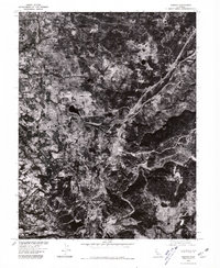
1975 Map of Auburn
USGS Topo · Published 1981About this map
Auburn and its surrounding foothills appear here as a mosaic of developed corridors and dense vegetation in the mid-1970s. This orthophotoquad, produced in cooperation with the Soil Conservation Service, uses aerial photography to reveal the fine-grained patterns of land use across the Placer County landscape. The large campus of the Dewitt State Hospital stands out as a significant institutional landmark on the west side of the city, while the winding course of the Middle Fork carves through the terrain to the south and east. Smaller settlements like Clipper Gap and Cool are visible as pockets of activity along the primary transportation routes, providing a detailed record of the region's suburban and rural expansion before the significant growth of later decades.
Find a feature on this map
5 named features on this map. Tap any name to fly to it.
Don’t see what you’re looking for? This feature index may not catch every label — zoom into the map to look around manually.
Map Details
Editions of this 1975 Auburn Map
This is the sole edition of this map. No revisions or reprints were ever made.
Other maps of this area

1888 · Smartsville
USGS Topo · 1:125,000

1891 · Sacramento
USGS Topo · 1:125,000

1891 · Colfax
USGS Topo · 1:125,000

1891 · Smartsville
USGS Topo · 1:125,000

1891 · Placerville
USGS Topo · 1:125,000

1892 · Sacramento
USGS Topo · 1:125,000

1892 · Placerville
USGS Topo · 1:125,000

1892 · Smartsville
USGS Topo · 1:125,000

1892 · Colfax
USGS Topo · 1:125,000

1893 · Placerville
USGS Topo · 1:125,000