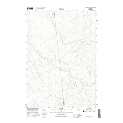
2016 Map of Augerhole Falls
USGS Topo · Published 2016About this map
The West Branch Saint Regis River meanders through this portion of the Adirondack Park Preserve, carving a path through a landscape defined by significant water features and elevation changes. The map identifies the site of Augerhole Falls and High Falls along the river's course, highlighting the hydraulic character of the region. This area on the border of St. Lawrence and Franklin counties is dotted with numerous glacial lakes and ponds, including Jordan Lake, Amber Lake, and the remote Wolf Pond. Human activity in this modern era is represented by a few key corridors such as Adirondack Rd and Kildare Rd, along with an ATV Trl, showing how recreation and forest management roads provide access to this interior wilderness.
Find a feature on this map
27 named features on this map. Tap any name to fly to it.
Don’t see what you’re looking for? This feature index may not catch every label — zoom into the map to look around manually.
Map Details
Editions of this 2016 Augerhole Falls Map
This is the sole edition of this map. No revisions or reprints were ever made.
Other maps of this area

1905 · Saint Regis
USGS Topo · 1:62,500

1919 · Nicholville
USGS Topo · 1:62,500

1920 · Childwold
USGS Topo · 1:62,500

1921 · Childwold
USGS Topo · 1:48,000

1921 · Nicholville
USGS Topo · 1:62,500

1921 · Santa Clara
USGS Topo · 1:62,500

1922 · Childwold
USGS Topo · 1:62,500

1923 · Santa Clara
USGS Topo · 1:62,500

1948 · Ogdensburg
USGS Topo · 1:250,000

1951 · Ogdensburg
USGS Topo · 1:250,000