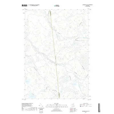
2019 Map of Augerhole Falls
USGS Topo · Published 2019About this map
Augerhole Falls and the West Branch Saint Regis River define the core of this wilderness corridor within the Adirondack Park Preserve. The landscape is dominated by a complex network of glacial ponds and wetlands, including Wolf Pond, Amber Lake, and Jordan Lake at the southern boundary. This area, straddling the line between St. Lawrence and Franklin Counties, reflects a contemporary state of preservation with very few developed roads. Primary access points are limited to Blue Mountain Rd and Kildare Rd, while an ATV Trl near Potter Pond indicates the recreational use of the backcountry. Small water bodies like Little Rock Pond and Maxey Pond are interconnected by brooks such as Elbow Brook and Windfall Brook, showing the intact drainage patterns of the northern Adirondacks.
Find a feature on this map
29 named features on this map. Tap any name to fly to it.
Don’t see what you’re looking for? This feature index may not catch every label — zoom into the map to look around manually.
Map Details
Editions of this 2019 Augerhole Falls Map
This is the sole edition of this map. No revisions or reprints were ever made.
Other maps of this area

1905 · Saint Regis
USGS Topo · 1:62,500

1919 · Nicholville
USGS Topo · 1:62,500

1920 · Childwold
USGS Topo · 1:62,500

1921 · Childwold
USGS Topo · 1:48,000

1921 · Nicholville
USGS Topo · 1:62,500

1921 · Santa Clara
USGS Topo · 1:62,500

1922 · Childwold
USGS Topo · 1:62,500

1923 · Santa Clara
USGS Topo · 1:62,500

1948 · Ogdensburg
USGS Topo · 1:250,000

1951 · Ogdensburg
USGS Topo · 1:250,000