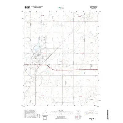
2018 Map of Augusta
USGS Topo · Published 2018About this map
The confluence of the Whitewater River and the Walnut River anchors the landscape of this Butler County region, where the city of Augusta has expanded into a structured network of residential streets and lakeside developments. The northern reaches of the city are defined by Augusta Lake and newer neighborhoods along Lakeside Dr and Stone Lake Dr, while the southern corridor reflects a long-established history. Genealogists will find significant value in the documentation of local burial grounds, including Elmwood Cem, Calvary Cem, and the more rural Sutton Cem to the north. To the east, the small settlement of Haverhill sits near the Airpark Estates Airport, illustrating the mix of aviation and agriculture that characterizes this part of Kansas. The river valleys, including the Little Walnut River and Turkey Creek, wind through a grid of section roads like SW Purity Springs Rd and SW Hopkins Switch Rd, marking the persistent agricultural character of the surrounding plains.
Find a feature on this map
102 named features on this map. Tap any name to fly to it.
Don’t see what you’re looking for? This feature index may not catch every label — zoom into the map to look around manually.
Map Details
Editions of this 2018 Augusta Map
This is the sole edition of this map. No revisions or reprints were ever made.
Other maps of this area

1888 · Eldorado
USGS Topo · 1:125,000

1889 · Wichita
USGS Topo · 1:125,000

1894 · Wichita
USGS Topo · 1:125,000

1955 · Santa Fe Lake
USGS Topo · 1:24,000

1955 · Benton
USGS Topo · 1:24,000

1955 · Douglass
USGS Topo · 1:24,000

1955 · Wichita
USGS Topo · 1:250,000

1958 · Wichita
USGS Topo · 1:250,000

1961 · Augusta
USGS Topo · 1:24,000

1961 · El Dorado
USGS Topo · 1:24,000