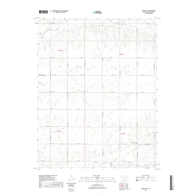
2018 Map of Augusta SE
USGS Topo · Published 2018About this map
Bloomington and Clay Center anchor this agricultural landscape in Butler County, where a dense grid of section roads defines the prairie terrain. The map reveals the intricate drainage patterns of the Flint Hills region, dominated by the winding paths of Hickory Creek in the north and Muddy Creek through the center. In the southern portion of the sheet, the headwaters of Rock Creek and its tributary, N Br Rock Creek, carve subtle valleys into the landscape. This 2018 survey provides a clear view of rural land divisions and local infrastructure, such as Latham-Clay Center Rd and Se Bluestem Rd. For those researching family history in the area, the Lone Star Cem is a significant landmark located near the southern border, while Chigger Creek meanders through the southwestern sections, offering a precise look at the township and range lines of T28S and T29S.
Find a feature on this map
36 named features on this map. Tap any name to fly to it.
Don’t see what you’re looking for? This feature index may not catch every label — zoom into the map to look around manually.
Map Details
Editions of this 2018 Augusta SE Map
This is the sole edition of this map. No revisions or reprints were ever made.
Other maps of this area

1888 · Eldorado
USGS Topo · 1:125,000

1889 · Burden
USGS Topo · 1:125,000

1955 · Wichita
USGS Topo · 1:250,000

1958 · Wichita
USGS Topo · 1:250,000

1961 · Augusta
USGS Topo · 1:24,000

1961 · Gordon
USGS Topo · 1:24,000

1963 · Leon
USGS Topo · 1:24,000

1964 · Augusta SE
USGS Topo · 1:24,000

1964 · Latham
USGS Topo · 1:24,000

1964 · Cambridge NW
USGS Topo · 1:24,000