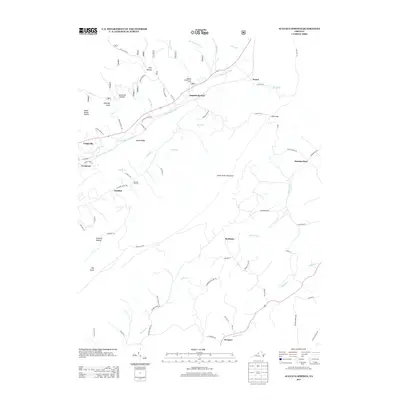
2013 Map of Augusta Springs
USGS Topo · Published 2013About this map
Augusta Springs and the surrounding Shenandoah Valley foothills are defined by the winding course of the Little Calfpasture River and the towering presence of Little North Mountain. The settlement pattern in this part of Augusta County reflects a long history of small communities connected by rural routes like Augusta Springs RD and McKinley RD. Industrial heritage is visible at Estaline Furnace, a remnant of the region's early iron production, located south of the Estaline settlement near Smith Cr. To the east, the Middle River and Moffatts Cr drain fertile lowlands where hamlets like McKinley and Summerdean are situated. The landscape transitions from the higher elevations of Big Knob and Sprouse Hollow to the established villages of Craigsville and Fordwick in the west, illustrating the rural-to-industrial shift common in this portion of Virginia.
Find a feature on this map
85 named features on this map. Tap any name to fly to it.
Don’t see what you’re looking for? This feature index may not catch every label — zoom into the map to look around manually.
Map Details
Editions of this 2013 Augusta Springs Map
This is the sole edition of this map. No revisions or reprints were ever made.
Other maps of this area

1894 · Staunton
USGS Topo · 1:125,000

1894 · Lexington
USGS Topo · 1:125,000

1932 · Lexington
USGS Topo · 1:48,000

1936 · Vesuvius
USGS Topo · 1:48,000

1937 · Lexington
USGS Topo · 1:62,500

1941 · Vesuvius
USGS Topo · 1:62,500

1943 · Craigsville
USGS Topo · 1:62,500

1944 · Staunton
USGS Topo · 1:62,500

1945 · Craigsville
USGS Topo · 1:62,500

1947 · Staunton
USGS Topo · 1:62,500