
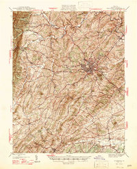
1947 Map of Staunton
USGS Topo · Published 1947About this map
Staunton serves as the central hub of this 1940s landscape, where the Chesapeake and Ohio railroad meets a dense network of roads like Route 11 and Route 250. The topography is defined by the sharp rise of North Mountain and the prominent heights of Betsy Bell and Mary Gray just east of the city center. This period captures a mid-century balance of urban growth in neighborhoods like College Park and the deeply rooted rural character of the surrounding Shenandoah Valley.
Find a feature on this map
88 named features on this map. Tap any name to fly to it.
Don’t see what you’re looking for? This feature index may not catch every label — zoom into the map to look around manually.
Map Details
Editions of this 1947 Staunton Map
2 editions found
Other maps of this area

1892 · Buckingham
USGS Topo · 1:125,000

1892 · Harrisonburg
USGS Topo · 1:125,000

1894 · Staunton
USGS Topo · 1:125,000

1894 · Lexington
USGS Topo · 1:125,000

1924 · Mc Dowell
USGS Topo · 1:62,500

1932 · Lexington
USGS Topo · 1:48,000

1934 · Waynesboro
USGS Topo · 1:48,000

1936 · Vesuvius
USGS Topo · 1:48,000

1937 · Lexington
USGS Topo · 1:62,500

1939 · Waynesboro
USGS Topo · 1:62,500