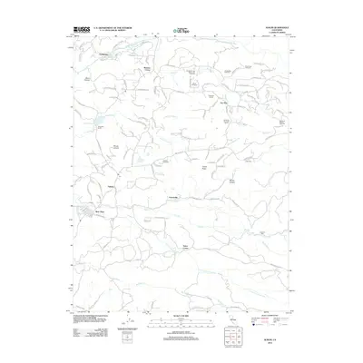
2012 Map of Aukum
USGS Topo · Published 2012About this map
River Pines and the surrounding Sierra Nevada foothills are defined by a network of drainage basins and an emerging viticulture industry in this 2012 survey. The terrain is deeply etched by the Middle Fork Cosumnes River to the north and the S Fork Cosumnes River to the south, with numerous tributaries such as Scott Cr and Big Indian Cr shaping the local geography. Small community centers and named crossroads including Aukum, Melsons Corner, and Fair Play anchor the landscape, which is increasingly populated by commercial agriculture as evidenced by Granite Springs Winery and Vineyards and Perry Creek Vineyards. Historic land use is still visible through landmarks like Lawrence Mill and the D'Agostini Ranch, illustrating the transition from traditional ranching and milling to the modern vineyard-driven economy that characterizes this part of Amador County.
Find a feature on this map
121 named features on this map. Tap any name to fly to it.
Don’t see what you’re looking for? This feature index may not catch every label — zoom into the map to look around manually.
Map Details
Editions of this 2012 Aukum Map
This is the sole edition of this map. No revisions or reprints were ever made.
Other maps of this area

1889 · Jackson
USGS Topo · 1:125,000

1891 · Placerville
USGS Topo · 1:125,000

1892 · Jackson
USGS Topo · 1:125,000

1892 · Placerville
USGS Topo · 1:125,000

1893 · Placerville
USGS Topo · 1:125,000

1897 · Jackson
USGS Topo · 1:125,000

1902 · Jackson
USGS Topo · 1:125,000

1941 · Sutter Creek
USGS Topo · 1:62,500

1944 · Sutter Creek
USGS Topo · 1:62,500

1947 · Sacramento
USGS Topo · 1:250,000