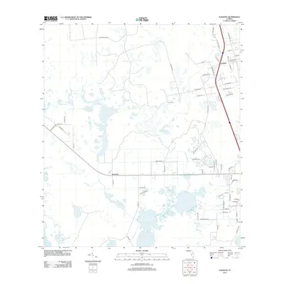
2012 Map of Aurantia
USGS Topo · Published 2012About this map
The low-lying wetlands and palm-studded prairies of Brevard County define this 2012 study, where the small settlement of Aurantia serves as a primary local node. The landscape is dominated by an intricate system of lakes and sloughs, including the prominent Salt Lake and the elongated Loughman Lake, which drain toward the south-flowing St Johns R. In the western portion of the quadrangle, Cabbage Slough and Buck Lake illustrate the area's characteristic hydrology. Human presence is concentrated along a network of numbered and named routes, such as Railroad St and Harrison Rd, while the settlement of Southmere marks a central point along the east-west corridor. Local landmarks like the Pistol Range Rd and Gun Club Ln reflect specialized land use in this largely rural expanse, which remains defined by its proximity to the vast freshwater resources of Freshwater Lake and Ellis Lake.
Find a feature on this map
70 named features on this map. Tap any name to fly to it.
Don’t see what you’re looking for? This feature index may not catch every label — zoom into the map to look around manually.
Map Details
Editions of this 2012 Aurantia Map
This is the sole edition of this map. No revisions or reprints were ever made.
Other maps of this area

1949 · Oak Hill
USGS Topo · 1:24,000

1949 · Titusville
USGS Topo · 1:24,000

1949 · Mims
USGS Topo · 1:24,000

1949 · Osceola
USGS Topo · 1:24,000

1950 · Maytown
USGS Topo · 1:24,000

1950 · Aurantia
USGS Topo · 1:24,000

1952 · Mims
USGS Topo · 1:24,000

1952 · Titusville
USGS Topo · 1:24,000

1953 · Geneva
USGS Topo · 1:24,000

1953 · Titusville SW
USGS Topo · 1:24,000