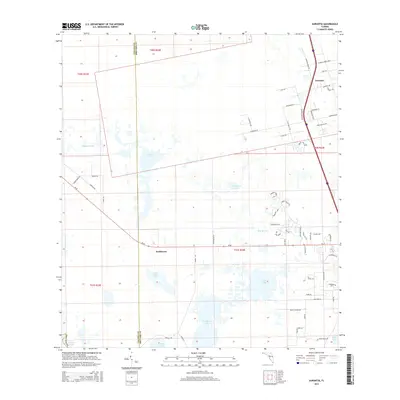
2015 Map of Aurantia
USGS Topo · Published 2015About this map
The boundary between Volusia and Brevard counties cuts through a complex network of wetlands and shallow basins just west of the Atlantic coast. This landscape is defined by its diverse hydrologic features, ranging from the expansive Salt Lake and Loughman Lake to smaller, isolated bodies like Freshwater Lake and Ellis Lake. The settlement of Aurantia occupies the northeastern corner, characterized by a grid of residential streets such as Golden Shores Blvd and Aurantia Rd. To the southwest, the smaller locality of Southmere sits near the crossing of SR-46. This road acts as a primary east-west artery, bridging the gap between the upper reaches of Sixmile Creek and the marshy stretches of Cabbage Slough and Puzzle Lake. The map reveals a transition from the structured neighborhood of Aurantia to the open, water-dominated terrain of the St. Johns River system.
Find a feature on this map
64 named features on this map. Tap any name to fly to it.
Don’t see what you’re looking for? This feature index may not catch every label — zoom into the map to look around manually.
Map Details
Editions of this 2015 Aurantia Map
This is the sole edition of this map. No revisions or reprints were ever made.
Other maps of this area

1949 · Oak Hill
USGS Topo · 1:24,000

1949 · Titusville
USGS Topo · 1:24,000

1949 · Mims
USGS Topo · 1:24,000

1949 · Osceola
USGS Topo · 1:24,000

1950 · Maytown
USGS Topo · 1:24,000

1950 · Aurantia
USGS Topo · 1:24,000

1952 · Mims
USGS Topo · 1:24,000

1952 · Titusville
USGS Topo · 1:24,000

1953 · Geneva
USGS Topo · 1:24,000

1953 · Titusville SW
USGS Topo · 1:24,000