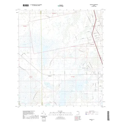
2021 Map of Aurantia
USGS Topo · Published 2021About this map
Buck Lake and its vast surrounding wetlands dominate this landscape along the border of Volusia and Brevard counties. This area is characterized by an intricate network of water bodies, including Salt Lake, Loughman Lake, and the expansive Spruce Creek Swamp. The settlement of Aurantia sits near the eastern edge, while the site of Southmere is located further south along the modern path of West Main Street. Modern recreational and conservation efforts are evident through the East Central Regional Rail Trail and the Seminole Ranch Conservation Area Trail, which utilize the corridor of a former rail line. The presence of Puzzle Lake and Shad Creek indicates the seasonal fluctuations of the St. Johns River basin, showing how the environment continues to shape local infrastructure and land use.
Find a feature on this map
65 named features on this map. Tap any name to fly to it.
Don’t see what you’re looking for? This feature index may not catch every label — zoom into the map to look around manually.
Map Details
Editions of this 2021 Aurantia Map
This is the sole edition of this map. No revisions or reprints were ever made.
Other maps of this area

1949 · Oak Hill
USGS Topo · 1:24,000

1949 · Titusville
USGS Topo · 1:24,000

1949 · Mims
USGS Topo · 1:24,000

1949 · Osceola
USGS Topo · 1:24,000

1950 · Maytown
USGS Topo · 1:24,000

1950 · Aurantia
USGS Topo · 1:24,000

1952 · Mims
USGS Topo · 1:24,000

1952 · Titusville
USGS Topo · 1:24,000

1953 · Geneva
USGS Topo · 1:24,000

1953 · Titusville SW
USGS Topo · 1:24,000