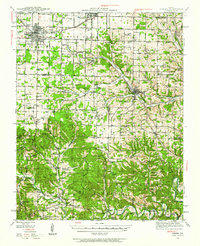
1942 Map of Aurora
USGS Topo · Published 1962About this map
Aurora and Marionville anchor this early 1940s landscape, a region defined by the convergence of major rail lines and the intricate drainage of the Spring River and Crane Creek. The Missouri Pacific RR and St. Louis - San Francisco RR cut through the terrain, serving a network of small upland settlements like Talmage, Elsey, and Jenkins. The landscape transitions from the open stretches of Buck Prairie in the north to the deeply incised hollows and ridges of the southern hills, where numerous springs and caves, such as Upshaw Spr and Pigeon Roost Cave, suggest the complex karst geography of the area.
Find a feature on this map
104 named features on this map. Tap any name to fly to it.
Don’t see what you’re looking for? This feature index may not catch every label — zoom into the map to look around manually.
Map Details
Editions of this 1942 Aurora Map
2 editions found
Other maps of this area

1884 · Springfield
USGS Topo · 1:125,000

1886 · Greenfield
USGS Topo · 1:125,000

1886 · Springfield
USGS Topo · 1:125,000

1888 · Greenfield
USGS Topo · 1:125,000

1907 · Forsyth
USGS Topo · 1:125,000

1919 · Halltown
USGS Topo · 1:62,500

1921 · Stotts City
USGS Topo · 1:62,500

1927 · Shell Knob
USGS Topo · 1:62,500

1937 · Cassville
USGS Topo · 1:48,000

1942 · Aurora
USGS Topo · 1:62,500