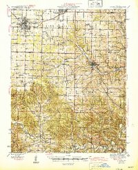
1945 Map of Aurora
USGS Topo · Published 1945About this map
The town of Aurora serves as the industrial and transport hub of this 1940s landscape, where the St Louis-San Francisco RR and Missouri Pacific RR intersect to move the region's agricultural and mineral wealth. This era in southwest Missouri reveals a high density of rural institutions, particularly within the Buck Prairie and Hurley districts, where numerous country schools and churches like Talmage Sch and Shiloh Ch anchored small farming communities. To the south, the terrain becomes more varied around Jenkins Mountain, marked by natural features like Pigeon Roost Cave and Upshaw Spr. This survey preserves the location of specialized sites, including a Lead Mine near Jenkins, and curious landmarks like the Bean Factory Spg, reflecting a period when local springs and family-named schools like Doland Sch were the primary landmarks for residents in the Lincoln and Logan townships.
Find a feature on this map
96 named features on this map. Tap any name to fly to it.
Don’t see what you’re looking for? This feature index may not catch every label — zoom into the map to look around manually.
Map Details
Editions of this 1945 Aurora Map
2 editions found

Other maps of this area

1884 · Springfield
USGS Topo · 1:125,000

1886 · Greenfield
USGS Topo · 1:125,000

1886 · Springfield
USGS Topo · 1:125,000

1888 · Greenfield
USGS Topo · 1:125,000

1907 · Forsyth
USGS Topo · 1:125,000

1919 · Halltown
USGS Topo · 1:62,500

1921 · Stotts City
USGS Topo · 1:62,500

1927 · Shell Knob
USGS Topo · 1:62,500

1937 · Cassville
USGS Topo · 1:48,000

1942 · Aurora
USGS Topo · 1:62,500